

Caution: Some of these links are to sites that have not been updated for quite some time.
Routes/Points of Interest
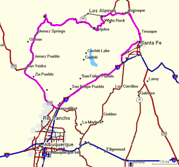 Route: Jemez Mountain Trail - Loop Via Sante Fe, NM
Great day trip or even longer. Travel in clockwise direction is recommended. Waypoints for scenic and cultural attractions. Most waypoints include links to descriptive web sites. Includes:- Nominal start in Bernalillo (food, lodging, gas), just north of Albuquerque
- Coronado State Monument (ancient pueblo, small museum)
- San Ysidro (gas, c-store)
- Jemez Pueblo (Walatowa Visitor Center and NP service desk. No photography in pueblo.)
- Jemez Springs (food, hot springs, lodging)
- Jemez State Monument (ancient ruins of pueblo and mission church)
- La Cueva (food, lodging)
- Valles Caldera National Preserve (hiking)
- Bandelier National Monument (cliff dwellings, museum, camping nearby)
- Optional side trip to Los Alamos (food, gas, lodging, museums)
- Optional sight-seeing in Santa Fe (food, lodging, museums, shopping, gas)
- Optional side trips to pueblos - waymarks are for exit off route, not pueblo sites.
(Please view the etiquette page if you plan on visiting one or more of the pueblos) - Download GPX Route file or Garmin ver3 GDB Route file
- POIs: Chaco Canyon National Historic Park "Chaco Culture National Historical Park preserves one of America's most significant cultural and historic areas. Chaco Canyon was a major center of Puebloan culture between AD 850 and 1250. The Chacoan sites are part of the sacred homeland of Pueblo Indian peoples of New Mexico, the Hopi Indians of Arizona, and the Navajo Indians of the Southwest, all of whom continue to respect and honor them. Chaco Culture National Historical Park is a very special place. Remote and isolated, it offers few amenities, so come prepared." NPS
Route information. If you use autorouting set your destination as Route Pt. 1 only. Then follow County Road 7900 to County Road 7950, which you follow into the park. This is the official NPS approved route. Autorouting software gets confused by all the dirt roads in the area and should not be used.
- Waypoints:
- Route Pt. 1 - turn off US550, formerly NM44
- Route Pt. 2 - junction
- Visitor Center
- Campground
- Hungo Pavi
- Pueblo de Arroyo
- Pueblo Bonito
- Una Vida
- Download GPX POIs or Garmin ver3 GDB POIs
These files are licensed under a
Creative Commons Attribution-Noncommercial-No Derivative Works 3.0 United States License.
Your feedback is appreciated. Use email link above. Thanks and enjoy.
 Geocaching & Related Links:
- Geocaching.com - the mothership of geocaching
- Waymarking - provides tools for you to catalog, mark and visit interesting and useful locations around the world.
Geometry Links:
Cartography & Map Links:
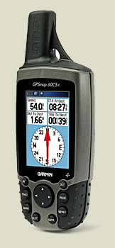
GPS Links:
- GPS Information Net - excellent resource for all things GPS, incl. hardware, software, maps. etc.
- GPS Passion - another excellent resource
- Custom Points Of Interest:
- Garmin POI Loader Article excellent article, especially if you have a Garmin.
- POI Factory (free site)
- POI in USA (forum format) lots of cool free collections
Benchmarks
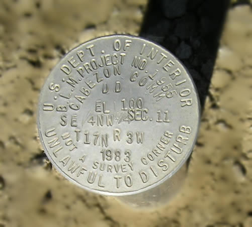
Cabezon Community Reservoir dam
N 35° 38' 03" W 107° 07' 34" (estimated, not measured)